What is a Weather Map?
A weather map is a visual representation of various meteorological features across a certain area at a particular point in time. Meteorologists use weather maps to forecast weather conditions and patterns. You’ve probably seen one on TV or online – they’re filled with different colors, lines, and symbols.
Key Elements of a Weather Map
Here are some of the main elements you’ll see on a weather map:
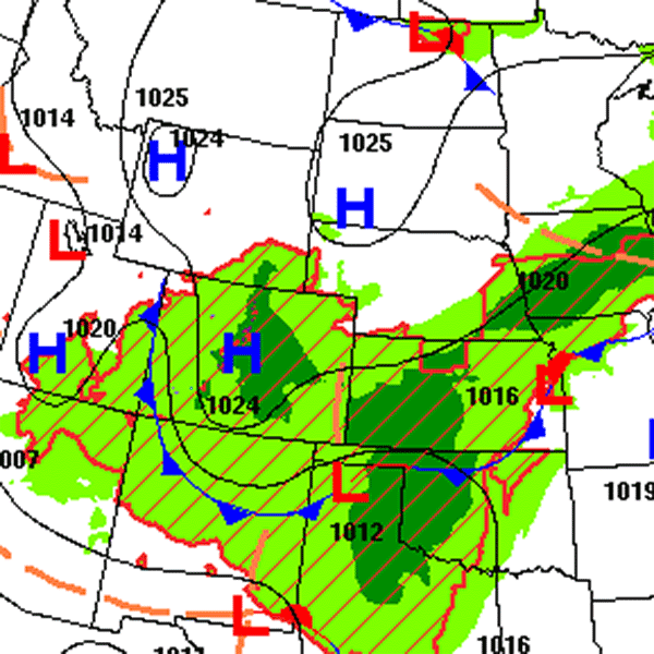
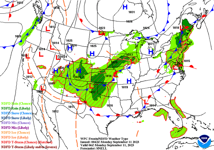
- Isobars: These are lines that connect points of equal atmospheric pressure. They can tell us about wind speed and direction. Closely spaced isobars indicate high winds, while widely spaced isobars suggest calm winds.
- Fronts: A front is a boundary between two different air masses. On a weather map, cold fronts are typically represented by a blue line with triangles, and warm fronts are shown as a red line with semi-circles. Fronts are often associated with changes in weather conditions.
- High and Low Pressure Systems: High pressure systems (marked with an “H”) usually bring clear, fair weather, while low pressure systems (marked with an “L”) often bring clouds and precipitation.
- Precipitation: Weather maps often show areas of expected rain, snow, sleet, or hail. This can be indicated by different colors or patterns.
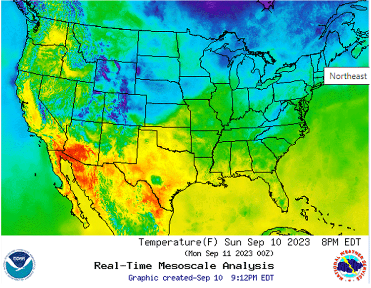
- Temperature: Some weather maps use colors to show temperature ranges. Warmer temperatures are often shown in reds and oranges, while cooler temperatures are depicted in blues and purples.
How to Read a Weather Map
Reading a weather map is like solving a puzzle. Here’s a simple guide to help you:
- First, identify the key or legend. This will explain what the different symbols and colors on the map represent.
- Look for high and low pressure systems. Remember, “H” usually means good weather, and “L” often means bad weather.
- Find the fronts. These will give you an idea of where the weather is likely to change.
- Check out the isobars. They can tell you how windy it might be.
- Finally, look at the precipitation and temperature information. This will give you an idea of what to expect in terms of rain, snow, and temperature.
Why are Weather Maps Important?
Weather maps are essential tools for meteorologists. They help them predict future weather conditions, which can be used to warn people about severe weather, help farmers plan their planting and harvesting, and even assist pilots in planning flight paths.
Understanding weather maps also helps us make everyday decisions, like what to wear or whether to carry an umbrella.
Wrapping Up the Weather Map Journey
Weather maps may seem complex at first glance, but with a bit of practice, you’ll be able to read them like a pro. So next time you see a weather map, take a moment to study it – you’ll gain a deeper understanding of the weather patterns around you!